Mahabubabad District Overview
Mahabubabad District is one of the prominent districts of Telangana, known for its rich tribal culture, historical heritage, natural beauty, and agricultural significance. The district was formed on October 11, 2016, as part of the reorganization of districts in Telangana State. Surrounded by forests, waterfalls, temples, and fertile lands, Mahabubabad serves as an important administrative and economic center in the region. The district is home to diverse communities, preserving traditions while embracing modern development.
The History and Heritage of Mahabubabad
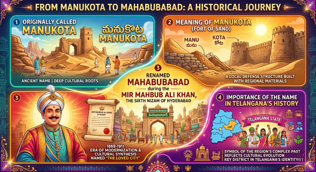
Mahabubabad, a region of profound historical significance in Telangana, was originally known as Manukota, a name deeply rooted in its heritage meaning “Fort of Sand” (derived from the words Manu, meaning soil/sand, and Kota, meaning fort). The area underwent a major transformation during the reign of Mir Mahbub Ali Khan, the sixth Nizam of Hyderabad, when it was officially renamed Mahabubabad in his honor. This transition from Manukota to Mahabubabad highlights the layered evolution of Telangana’s history, reflecting the intersection of local defensive geography, language, and the profound socio-political shifts under the Asaf Jahi dynasty.Mahabubabad acts as a vital resource hub for Telangana due to its substantial Bayyaram iron ore deposits, while also functioning as a crucial transportation gateway powered by the major Dornakal Railway Junction, which historically linked the region to the broader trade networks of the Nizam’s State Railway.
Mahabubabad Through the Ages
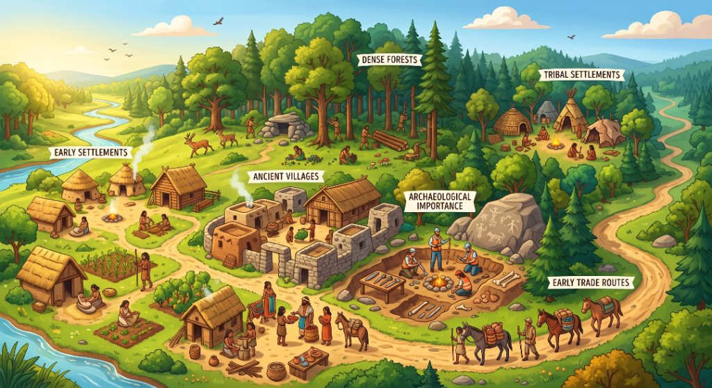
The rich historical landscape of Mahabubabad District, visually mapped out, is anchored by its deep archaeological importance and early tribal settlements that thrived within its dense forests and natural resource reserves. Long before modern administration, its vast woodlands—which still blanket 32% of the district today—sheltered ancient villages like those of the historic Koravi Seema, a medieval territory crucial to the Vengi Chalukya and Kakatiya eras. This naturally fortified terrain served as a massive hub for the indigenous Lambadi (Banjara) tribes, while its early trade routes acted as vital economic corridors that facilitated the transport of forest produce, agricultural goods, and minerals, eventually laying the historical foundation for the major railway junctions and trade paths that define the region today.
Mahabubabad During the Kakatiya Era
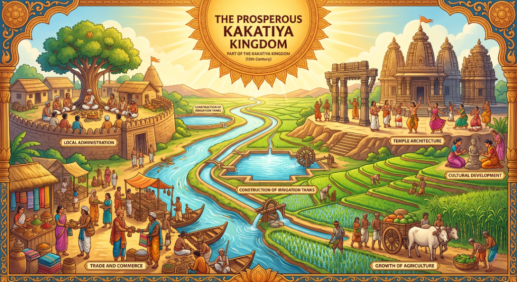
As the foundational heartland of the Kakatiya Kingdom (12th–14th centuries CE), the region corresponding to Mahabubabad District depicted underwent an economic and cultural renaissance. The Kakatiya rulers systematically catalyzed the growth of agriculture across this forested terrain through the construction of massive irrigation tanks and chain-link reservoirs, transforming dry lands into highly fertile paddy fields. This agrarian surplus funded magnificent temple architecture and religious monuments, while a sophisticated system of local administration—governed by loyal military commanders (Nayakas)—ensured stability and security. This structured governance actively fostered vibrant trade and commerce, positioning the district’s historic corridors as busy trade routes for agricultural produce and textiles, which ultimately fueled a rich cultural development that deeply blended grand classical arts with the region’s enduring tribal traditions.
The Rich Tribal Culture of Mahabubabad
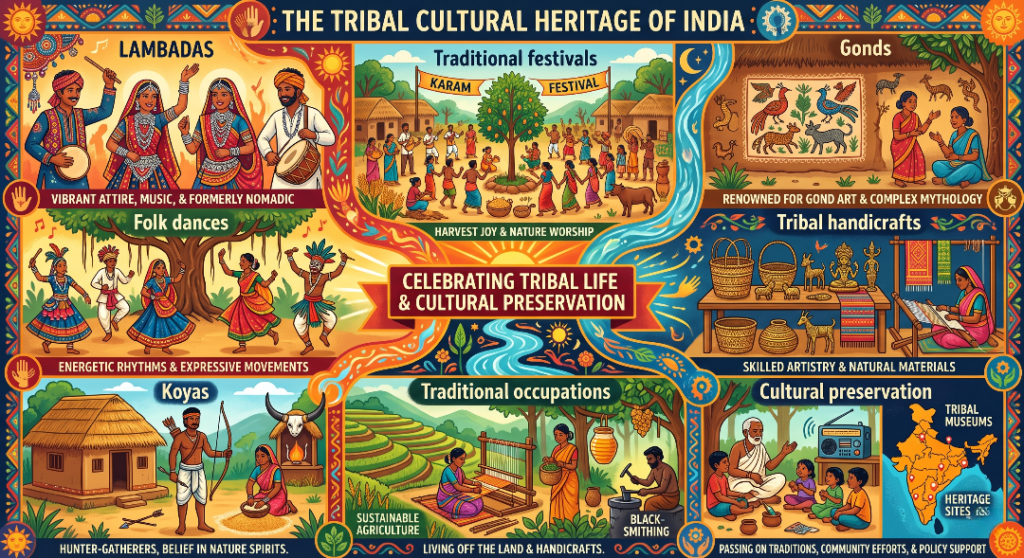
The vibrant cultural landscape of Mahabubabad District, anchored within the geographic heartland outlined is profoundly shaped by its diverse indigenous communities, primarily the Lambadas (Banjaras), along with pockets of Koyas and Gonds. These tribal communities have maintained a deep connection to their ancestral lands through traditional occupations like agriculture, forest produce collection, pastoralism, and intricate tribal handicrafts, such as mirror-work embroidery and specialized metal crafts. Their distinct heritage thrives through the cultural preservation of vibrant folk dances like Langa Voni or rhythmic tribal group dances, which come alive during traditional festivals like Teej and Seetla (celebrated by the Lambadas) alongside regional events. This enduring cultural legacy remains a cornerstone of the district’s identity, ensuring that ancient tribal folklore and customary lifestyle practices are actively passed down through generations.
Birth of Mahabubabad District
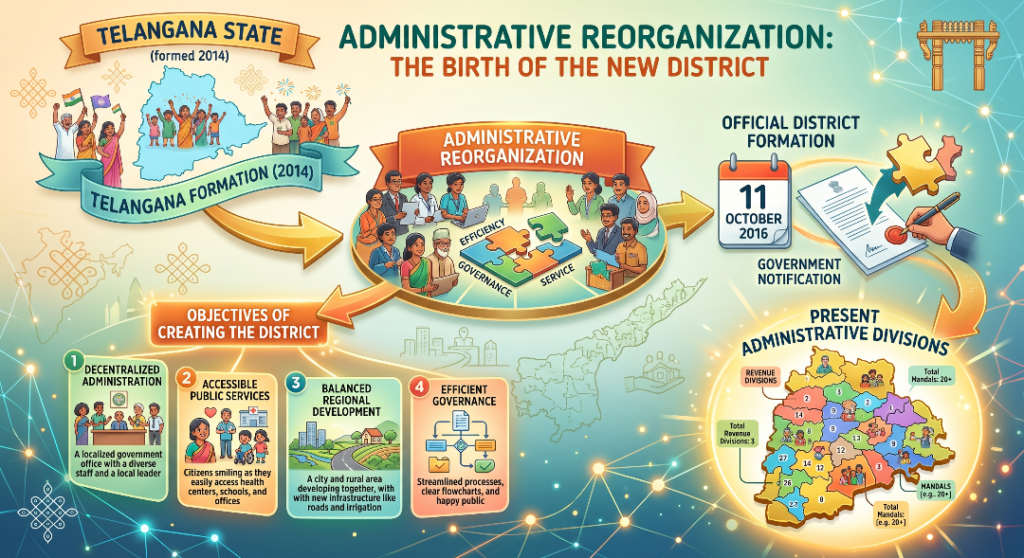
Following the historic Telangana state formation on June 2, 2014, the newly established state government initiated a massive administrative reorganization to decentralize governance and make it highly accessible to the public. As a direct outcome of this restructuring, the official district formation of Mahabubabad took place on 11 October 2016, carved out predominantly from the erstwhile Warangal district along with portions of Khammam district. The primary objectives of creating the district were to accelerate socioeconomic development, streamline local public services, and drastically improve the administration of heavily rural and tribal-dominated hinterlands that were previously underserved. In terms of its present administrative divisions, Mahabubabad is effectively organized for citizen convenience into 2 Revenue Divisions (Mahabubabad and Thorrur) which are further sub-divided into 16 Mandals, ensuring smooth governance and rapid distribution of welfare initiatives.
Mahabubabad – The Cultural Heart of Eastern Telangana
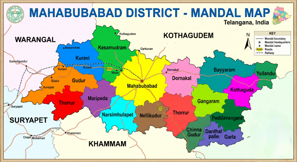
The provided map of the Mahabubabad District in Telangana, India, offers a bright and highly legible overview of the region’s administrative layout. Each of the 16 mandals is clearly demarcated using distinct, vibrant colors, allowing for effortless visual identification of areas like Mahabubabad, Kuravi, Kesamudram, Dornakal, Gudur, Bayyaram, and Thorrur. Beyond simple boundaries, the map effectively plots key mandal headquarters, major towns, and crucial transport links—including prominent roads, National Highways like NH-365, and railway networks. Complete with a helpful legend, a directional compass, and clear labels for surrounding districts like Warangal, Kothagudem, Khammam, and Suryapet, this map serves as an excellent, user-friendly reference for understanding the district’s geography and connectivity.
Mahabubabad's Famous Product
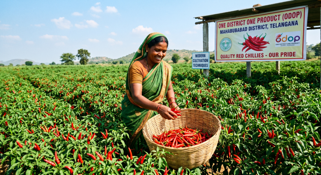
Red Chillies are the One District One Product (ODOP) of Mahabubabad District, playing a significant role in the region’s agricultural economy. The district’s fertile soil, favorable climate, and dedicated farming community enable the cultivation of high-quality chillies known for their rich color, pungency, and market value. Chilli farming provides livelihoods to thousands of farmers and contributes substantially to the district’s rural economy. Under the One District One Product (ODOP) initiative, the Government promotes modern cultivation techniques, value addition, food processing, packaging, branding, and market access to enhance farmers’ income and strengthen Mahabubabad’s identity as a leading chilli-producing district. Today, Mahabubabad’s red chillies are recognized for their quality and continue to support sustainable agricultural growth and economic development.
Municipalities & Major Towns
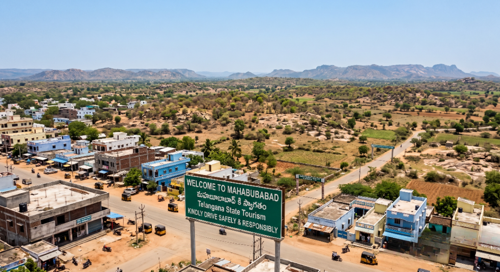
Mahabubabad
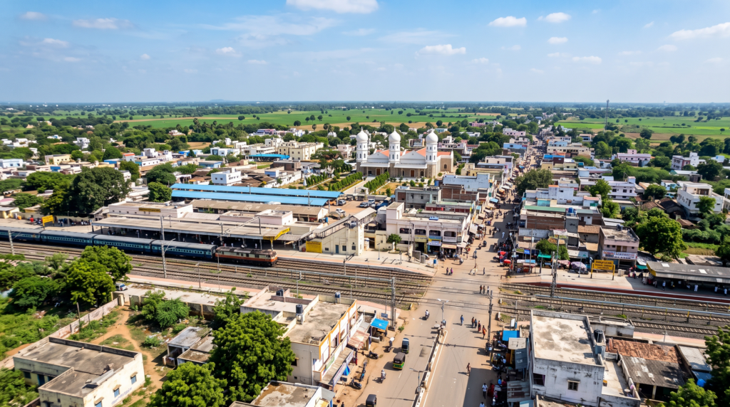
Dornakal
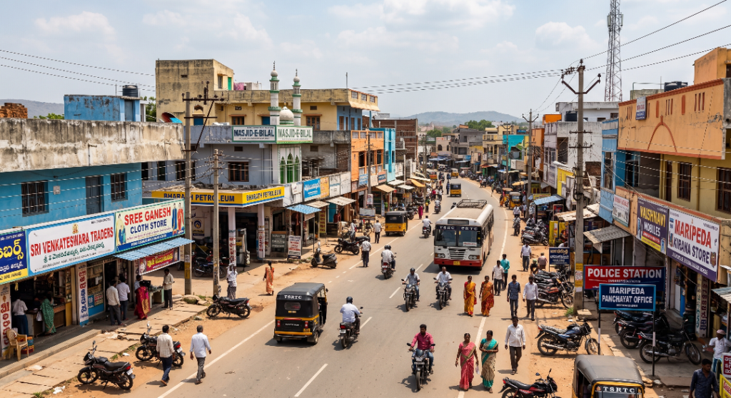
Maripeda
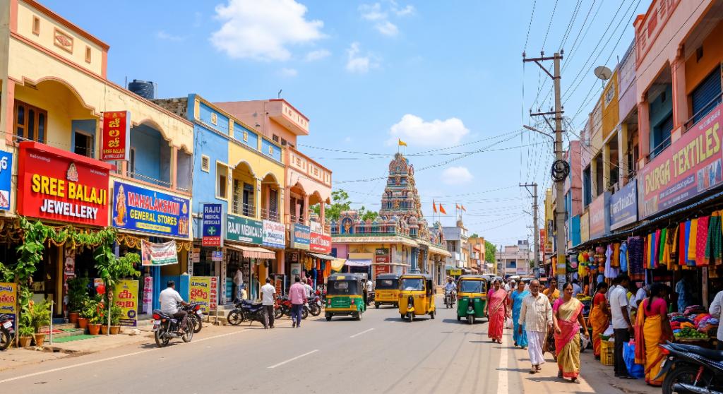
Thorrur
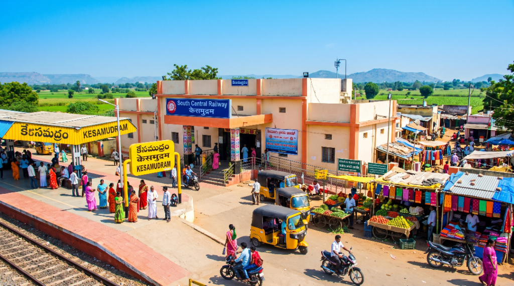
Kesamudram
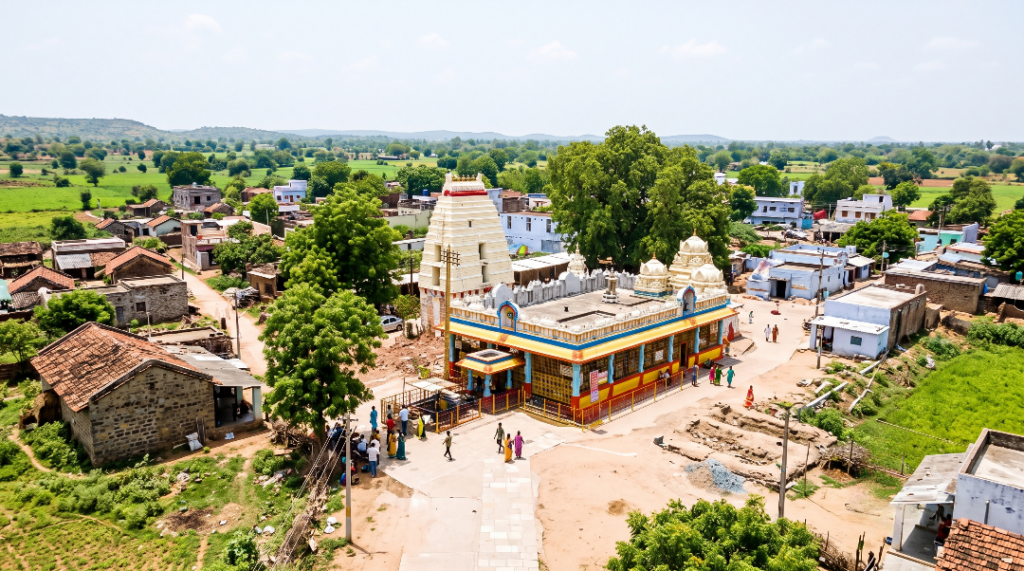
Kuravi
Mahabubabad District Population Profile
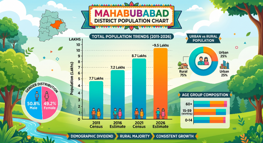
The population chart infographic for Mahabubabad district. highlights a trajectory of steady growth, showing the total population rising from 7.7 lakhs in the 2011 Census to an estimated 9.5 lakhs by 2026. Structurally, the district is heavily dominated by a rural majority, with 75% of the population residing in rural areas compared to just 25% in urban zones. The gender distribution is nearly equal, standing at 50.8% male and 49.2% female. Additionally, the data outlines the district’s age composition across three main brackets—0-14, 15-59 (the working age), and 60+—underscoring a prominent demographic dividend that aligns with its overall theme of consistent demographic expansion. Mahabubabad is heavily rural, with 75% of its population living in rural areas and only 25% in urban zones, while its age distribution highlights a prominent working-age bracket (15-59) that signals a strong demographic dividend.
Mahabubabad District: Key Statistics & Insights
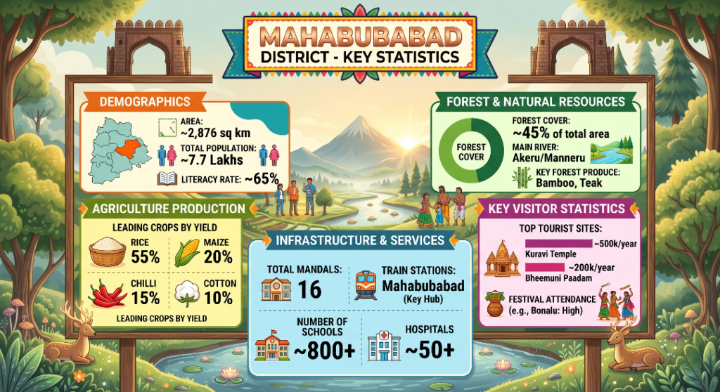
The updated key statistics infographic for Mahabubabad district presents a comprehensive, data-driven snapshot of the region’s profile across five main sectors. Demographically, the district spans an area of approximately 2,876 sq km with a total population of around 7.7 lakhs and a literacy rate of roughly 65%. Its agriculture sector is heavily driven by rice production, which makes up 55% of leading crop yields, followed by maize (20%), chilli (15%), and cotton (10%). The infrastructure and services data highlights a network of 16 total mandals, Mahabubabad station as the key railway hub, over 800 schools, and more than 50 hospitals. Forest and natural resources are a prominent feature, with forest cover accounting for about 45% of the total area, fed by the Akeru and Manneru rivers, and yielding key products like bamboo and teak. Finally, key visitor statistics show thriving tourism and cultural engagement, led by the Kuravi Temple drawing roughly 500,000 visitors per year.
Mahabubabad District: A Legacy of Forests, History, and Cultural Heritage
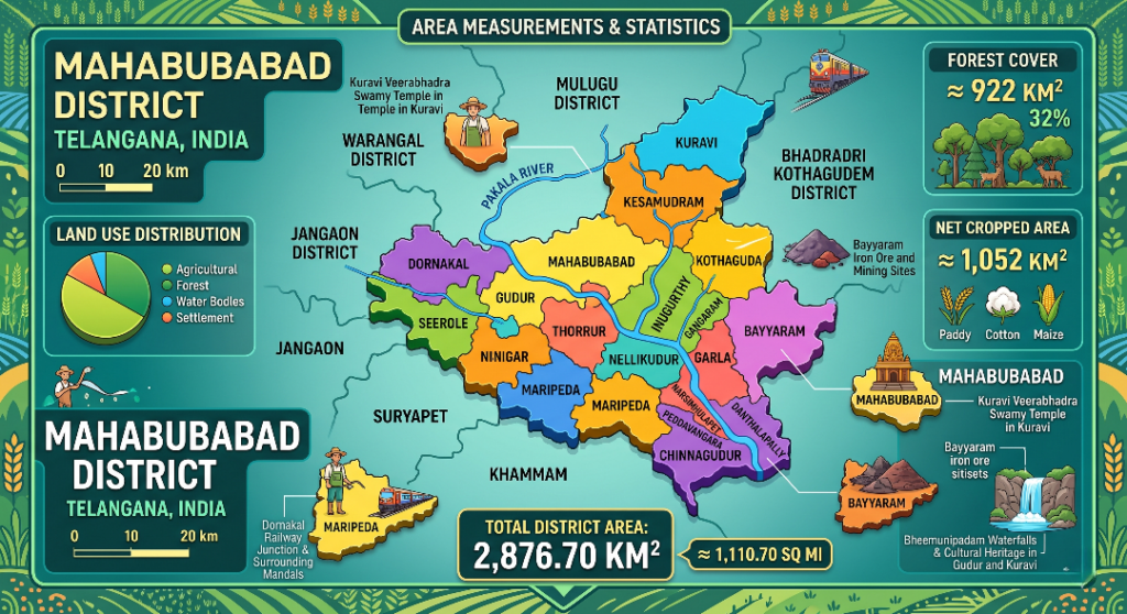
Mahabubabad District encompasses a total area of 2,876.70{ km}^2 ($1,110.70{ sq }) and features an extensive forest cover of 922{ km}^2 (32% of the district) alongside a substantial net cropped area of 1,052{ km}^2. Historically, this region holds deep roots in Telangana’s history as Manukota—a name derived from the Telugu Mranukota, which translates to a “Fort of Trees” (reflecting the ancient, densely wooded landscape that acted as a natural fortification, though it is occasionally misconstrued in folklore as a fort of sand). The settlement transitioned to its modern identity when it was renamed Mahabubabad during the reign of Mir Mahbub Ali Khan, the sixth Nizam of Hyderabad, following a royal visit where he or his high-ranking official stayed outside the town at a hunting lodge (Shikarkhana). This naming evolution serves as a powerful symbol in Telangana’s cultural timeline, illustrating how a heavily forested, tribal heartland structurally intertwined with the administrative shifts of the Asaf Jahi era to form a uniquely resilient district.
Financial Blueprint: Capital Investment & Sustainable Growth
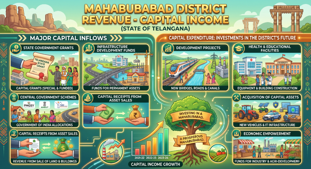
The financial blueprint of Mahabubabad District illustrates a strategic and robust cycle of capital management designed to ensure long-term regional development. The district’s Major Capital Inflows are anchored by substantial State Government Grants and Infrastructure Development Funds, which are systematically allocated toward building permanent assets. This financial strength is further bolstered by critical allocations from Central Government Schemes (such as PMGSY, AMRUT, and PMAY) alongside lucrative capital receipts generated from the sale of public assets like land and buildings. As highlighted by the upward-trending growth metrics from the fiscal years 2021-22 through 2023-24, these diverse revenue streams represent a steadily expanding capital base.